Yosemite Valley

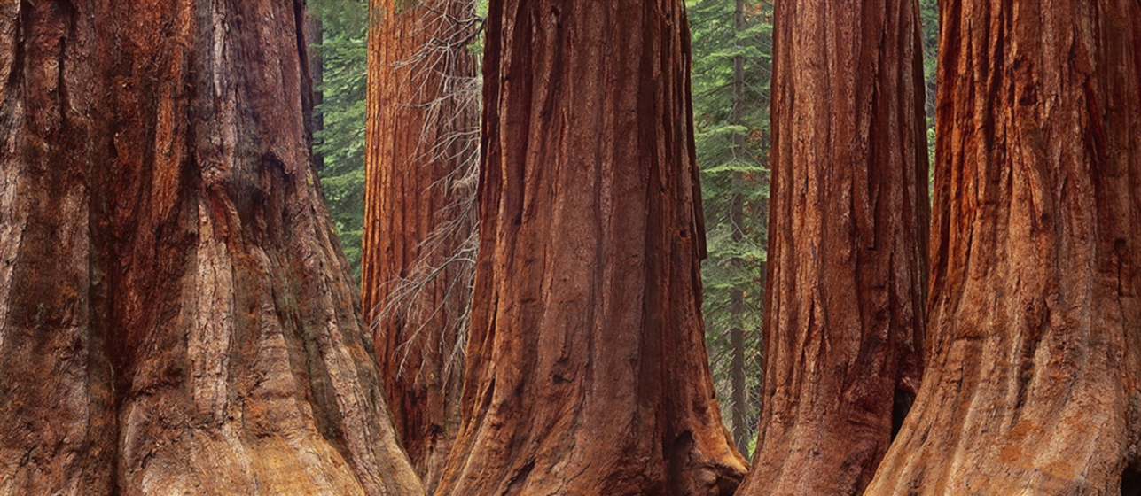
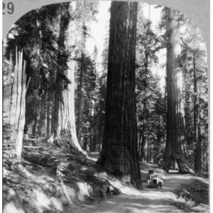
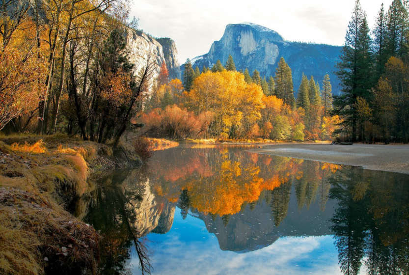
Yosemite Valley is a freak of nature. It’s only seven miles long and less than a mile wide, but it ranks higher in scenery per square foot than perhaps anywhere else in the world. Because it was formed by glaciation, the valley walls are sheer and high, leading to world-famous cliffs: El Capitan, a mountain-climbing mecca, rises more than 3,000 feet (900 meters) virtually straight up from the Yosemite Valley floor, and Half Dome looms 4,800 feet (1,600) meters above.

It’s also heaven for waterfalls. Why does central California fill up with storm clouds in the winter? Because adrenaline-junkie water droplets from all over the world are jostling to make it into the Sierra snowpack, just so they can spend twenty unforgettable seconds plunging over Yosemite or Bridalveil Falls.

Of course, these thrill-seeking waters are exhibitionists, too. They know that when they leap into the abyss, people will be watching them. Lots of people. This is Yosemite Valley’s curse – it’s a popular place. The crowds can be trying on summer weekends, and particularly on holiday weekends. If your schedule allows it, visit the valley on weekdays and spend your weekends exploring other parts of Yosemite – there’s no shortage of spectacular stuff in the rest of the park. Winter is also a great time to visit Yosemite Valley. The high country roads close in the winter, but the valley stays open and is much less crowded than during the summer.

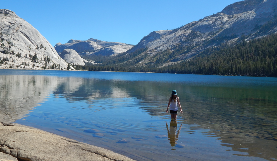
Although Yosemite Valley is most famous for the walls that surround it, the valley floor itself is also uncommonly pretty. The Merced River wanders through it, and meadows appear frequently along its length. Deer and coyotes are common sights, and bear are known to be about after dark. Yosemite Valley also has the most extensive network of bike paths anywhere in the park, and although you can drive or take free shuttle buses to much of the valley, bicycles are probably the most enjoyable way to get around here. If you didn’t bring your own bike, you can rent one at Curry Village, which lies near the east end of Yosemite Valley.

Hiking Trails in Yosemite Valley

TrailDistance
miles (km)
Elevation Gain
feet (meters)
Crowd FactorScenery FactorDifficulty
Artist Point2.0 (3.2)500 (150)Artist Point Crowd Factor: 2/5Artist Point Scenery Rating: 5/5
Bridalveil Fall1.2 (1.9)200 (60)Bridalveil Fall Crowd Factor: 5/5Bridalveil Fall Scenery Rating: 4/5
Columbia Rock3 (4.8)1,000 (300)Columbia Rock Crowd Factor: 4/5Columbia Rock Scenery Rating: 3/5
Four-Mile Trail4.7 (7.5)*3,200 (975)Four-Mile Trail Crowd Factor: 4/54-Mile Trail Scenery Rating: 5/5
Half Dome14.2 (22.7)*4,800 (1,600)Half Dome Trail Crowd Factor: 4/5Half Dome Trail Scenery Rating: 5/5
Happy Isles0.5 (0.8)*< 10Happy Isles Trail Crowd Factor: 3/5Happy Isles Trail Scenery Rating: 2/5
Inspiration Point2.6 (4.2)1,000 (300)Inspiration Point Crowd Factor: 2/5Inspiration Point Scenery Rating: 3/5
Mirror Lake & Tenaya Canyon2.4 (3.8)*< 100*Mirror Lake Crowd Factor: 5/5Mirror Lake Scenery Rating: 3/5
The Mist Trail (Vernal & Nevada Falls)3  (4.8)*1,000 (300)*Mist Trail Crowd Factor: 5/5Mist Trail Scenery Rating: 5/5
Panorama Trail8.5  (13.5)3,200 (975)Panorama Trail Crowd Factor: 4/5Panorama Trail Scenery Rating: 5/5
Pohono Trail13  (21)*3,700 (1,130)*Pohono Trail Crowd Factor: 3/5Pohono Trail Scenery Rating: 5/5
Sentinel / Cook’s Meadow Loop2.25 (3.6)< 10Sentinel/Cook's Meadow Loop Crowd Factor: 4/5Sentinel/Cook's Meadow Loop Scenery Rating: 4/5
Snow Creek Trail7.2 (11.6)*2,700 (820)*Snow Creek Trail Crowd Factor: 3/5Snow Creek Trail Scenery Rating: 3/5
Turtleback Dome1.2 (2)360 (110)Turtleback Dome Crowd Factor: 2/5Turtleback Dome Scenery Rating: 3/5
Vernal Fall Footbridge2 (3.2)300 (90)Vernal Fall Footbridge Crowd Factor: 5/5Vernal Fall Footbridge Scenery Rating: 3/5
Lower Yosemite Falls.5 (.8)*< 50*Lower Yosemite Falls Crowd Factor: 5/5Lower Yosemite Falls Scenery Rating: 5/5
Upper Yosemite Falls7.6 (12)*2,600 (790)*Upper Yosemite Falls Crowd Factor: 4/5Upper Yosemite Falls Scenery Rating: 5/5

* For hikes that have more than one possible route, this table lists distance and elevation for the shortest route. Or the longest one. Whatever seemed most interesting at the moment. Listed distances for most hikes are round trip; click on hike names for more details.

Take a Tour

Mariposa Grove of Giant Sequoia’s

Mariposa Grove of Giant Sequoia's

Mariposa Grove  reopened to the public on June 15, 2018, after a 3 year restoration. Mariposa Grove is home to 500 mature giant sequoias, the grand Grizzly Giant, one of Mariposa Grove’s oldest trees, is estimated to be around 1,800 years old and is a popular attraction among visitors to Yosemite National Park can be seen from the Grizzly Giant Loop and Mariposa Grove Trail. 

These big trees are not as impressive from far away as they are in person; they are magnificent, and worth the hike to observe them in all of their glory.

The term “big trees” doesn’t even begin to do the sequoias in the grove justice. The sequoias can grow over 300 feet tall. While their height is exceptional, it is their impressive and unbelievable girth that sets sequoias apart from other trees in the world. Their trunks can reach 100 feet in circumference–the measurement around the full width of the trunk–and they can spread more than 20 feet in diameter–the distance from one edge of the trunk to the other if you were to draw a line straight across.

Although these trees were logged in the early 1870s, (one of the reasons John Muir fought so hard to protect the sequoia groves surrounding Yosemite National Park). Their lumber was very brittle and wasn’t as useful as other trees in the area. This, among preservation efforts from other organizations, fortunately helped protect these giants in following years from further destruction.

Sequoias continually grow unlike mammals. Their age, girth and height work in unison to keep these organisms resilient. To reproduce, each tree needs to produce a single maturing offspring over its lifespan of several thousand years for the species to persist. The giant sequoias in the area only reproduce by seeds which can remain in the cone for upwards of 20 years. Forest fires help open the cones, which then grow from the burnt, naked soil, helping the reproduction process.

These massive and ancient giant sequoias can be found in three groves in Yosemite National Park. The most easily accessible of these from the spring through fall is the Mariposa Grove near the park’s south entrance, where the restoration took place, off of Wawona Road (Highway 41), and two smaller groves, the Tuolumne Grove and MercedGroves near Crane Flat.

The Mariposa Grove restoration project dedicated time and effort to protect hundreds of local sequoias, supporting the lives of these spectacular trees in Yosemite National Park for generations to come.

Hike Distances:
Big Trees Loop:  0.3 miles (0.4 km); includes Fallen Monarch
Grizzly Giant Loop:  2.0 miles (3.2 km); includes Fallen Monarch, Bachelor & Three Graces, Grizzly Giant, California Tunnel Tree
Guardians Loop:  6.5 miles (10.5 km); includes Grizzly Giant Loop trees plus upper grove
Mariposa Grove Trail:  7.0 miles (11.3 km) round trip; includes Grizzly Giant Loop trees plus Wawona Point and portions of upper grove

Elevation at trailhead:  5,600 feet (1,700 meters; 28 Grizzly Giants)
Big Tree Loop Elevation Gain:  very little
Grizzly Giant Loop Elevation Gain:  300 feet (90 meters)
Guardians Loop & Mariposa Grove Trail Elevation Gain:  1,200 feet (360 meters)

Hiking Time:  1 – 4 hours


Toulomne Meadows

Distance:  2 miles (3.2 km) more or less; it depends on how much wandering you want to do

Elevation at trailhead:  8,500 feet (2,550 meters)
Elevation gain:  none to speak of

Why visit Tuolumne Meadows?  There’s just something about a meadow that’s good for your peace of mind. And this is one of the great meadows, nearly two miles (3.2 km) long, with a river (the Tuolumne) winding through it and a variety of picturesque granite peaks and domes surrounding it.

Best Time to Visit:  It’s pretty whenever you can get there, but it’s especially striking early in the season, when the meadow is oh-so-green and full of wildflowers. And early comes later to Tuolumne Meadows than it does to the foothills or Yosemite Valley, so even if you overhibernated, there’s still a good chance you can catch spring in Tuolumne Meadows.

Crowd Factor:  It’s a popular spot, but it’s big, too, so you won’t be elbow to elbow with your fellow blissed-out wanderers.

Difficulty:  Tuolumne Meadows is an easy stroll; it rates a 1 or 2 out of 10, depending on how far you choose to go. About the only way to make this difficult is to turn Tuolumne Meadows into your running trail (it’s a great place for a run, by the way); you’ll soon realize that you’re above 8,000 feet.

Parking:  There’s parking scattered along the length of the meadow, in small lots and along the shoulders of the road. Starting from the center of the meadow will give you quick access to a picturesque bridge and the Soda Springs, but you can also find trails at the edges. Here’s a Google Street View panorama of the central trailhead, shot fairly early in the year before the meadow had turned green.

Nearest Restrooms:  At the visitor information center, across the road from the meadow

Nearest Snacks:  At the grill & convenience store near the east end of the meadow

Getting There:  From Yosemite Valley, take highway 120 ten miles (16.8 km) to the Crane Flat turnoff onto Tioga Road, then take Tioga Road 38 miles (61 km) east to reach the meadows. From Yosemite’s east entrance at Tioga Pass, take the Tioga Road west 8 miles (13 km) to the meadows.

Hazards:  In wet, marshy years, enter the meadow in the evenings without mosquito repellent at your own peril. You might also find things nippy if you hang out near the river, especially where it pools up near the west end of the meadow.

Our Location & Contact Information

1 (559) 683-7673
Your hosts are available daily from 8 am-8 pm PST 
Please call during these hours for questions or to make a reservation.

Badger Pass Ski Resort

Badger Pass ( yes they got their name back ) is a family friendly ski area. It is safe, easy and relaxing. The area is not intimidating like the larger ski areas. All the lifts leave from the one base area, and all the ski runs end back in the base area. Mom and Dad can watch their children from the lodge deck.

It is the oldest ski area in California and one of only three national parks that has a ski lift (the others being in Olympic National Park in Washington, and Cuyahoga Valley National Park in Ohio).

Choose a small downhill skiing and snowboarding area equipped with chair lifts or a 90-mile network of cross-country ski trails. 

Friendly instructors and rental equipment are available near the inner-tubing bunny hill for kids. For backcountry enthusiasts, overnight accommodations are available for cross-country skiers at Glacier Point and Ostrander Lake. Free shuttle buses connect the Yosemite Valley with Badger Pass at least twice daily. You can also drive yourself, but only if your car is equipped with snow tires and you bring tire chain

For More Information:
Badger Pass 
7082 Glacier Point Road, Yosemite National Park, CA 95389
(209) 372-8430