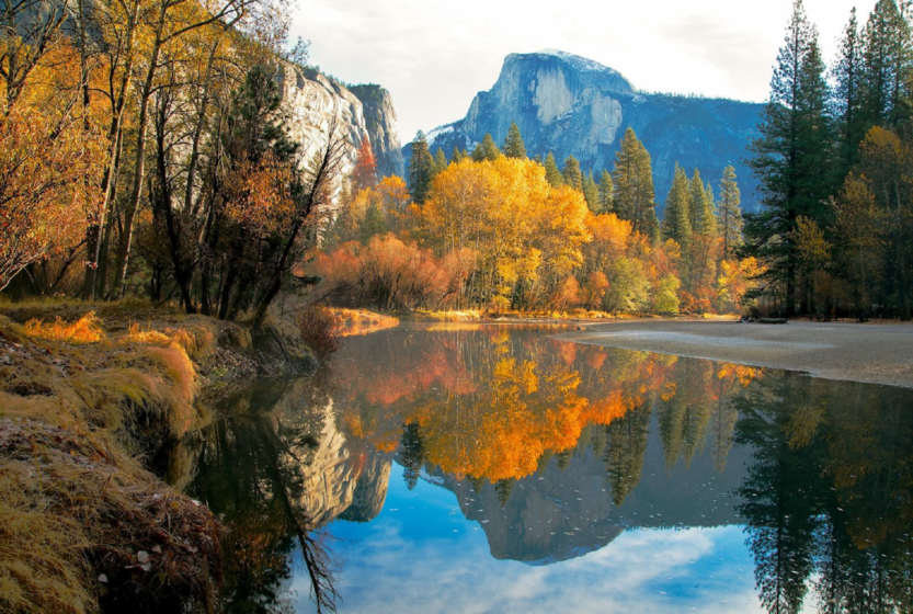
Yosemite Valley is a freak of nature. It’s only seven miles long and less than a mile wide, but it ranks higher in scenery per square foot than perhaps anywhere else in the world. Because it was formed by glaciation, the valley walls are sheer and high, leading to world-famous cliffs: El Capitan, a mountain-climbing mecca, rises more than 3,000 feet (900 meters) virtually straight up from the Yosemite Valley floor, and Half Dome looms 4,800 feet (1,600) meters above.
It’s also heaven for waterfalls. Why does central California fill up with storm clouds in the winter? Because adrenaline-junkie water droplets from all over the world are jostling to make it into the Sierra snowpack, just so they can spend twenty unforgettable seconds plunging over Yosemite or Bridalveil Falls.
Of course, these thrill-seeking waters are exhibitionists, too. They know that when they leap into the abyss, people will be watching them. Lots of people. This is Yosemite Valley’s curse – it’s a popular place. The crowds can be trying on summer weekends, and particularly on holiday weekends. If your schedule allows it, visit the valley on weekdays and spend your weekends exploring other parts of Yosemite – there’s no shortage of spectacular stuff in the rest of the park. Winter is also a great time to visit Yosemite Valley. The high country roads close in the winter, but the valley stays open and is much less crowded than during the summer.
Although Yosemite Valley is most famous for the walls that surround it, the valley floor itself is also uncommonly pretty. The Merced River wanders through it, and meadows appear frequently along its length. Deer and coyotes are common sights, and bear are known to be about after dark. Yosemite Valley also has the most extensive network of bike paths anywhere in the park, and although you can drive or take free shuttle buses to much of the valley, bicycles are probably the most enjoyable way to get around here. If you didn’t bring your own bike, you can rent one at Curry Village, which lies near the east end of Yosemite Valley.
Hiking Trails in Yosemite Valley
| Trail | Distance miles (km) | Elevation Gain feet (meters) | Crowd Factor | Scenery Factor | Difficulty |
|---|---|---|---|---|---|
| Artist Point | 2.0 (3.2) | 500 (150) | |||
| Bridalveil Fall | 1.2 (1.9) | 200 (60) | |||
| Columbia Rock | 3 (4.8) | 1,000 (300) | |||
| Four-Mile Trail | 4.7 (7.5)* | 3,200 (975) | |||
| Half Dome | 14.2 (22.7)* | 4,800 (1,600) | |||
| Happy Isles | 0.5 (0.8)* | < 10 | |||
| Inspiration Point | 2.6 (4.2) | 1,000 (300) | |||
| Mirror Lake & Tenaya Canyon | 2.4 (3.8)* | < 100* | |||
| The Mist Trail (Vernal & Nevada Falls) | 3 (4.8)* | 1,000 (300)* | |||
| Panorama Trail | 8.5 (13.5) | 3,200 (975) | |||
| Pohono Trail | 13 (21)* | 3,700 (1,130)* | |||
| Sentinel / Cook’s Meadow Loop | 2.25 (3.6) | < 10 | |||
| Snow Creek Trail | 7.2 (11.6)* | 2,700 (820)* | |||
| Turtleback Dome | 1.2 (2) | 360 (110) | |||
| Vernal Fall Footbridge | 2 (3.2) | 300 (90) | |||
| Lower Yosemite Falls | .5 (.8)* | < 50* | |||
| Upper Yosemite Falls | 7.6 (12)* | 2,600 (790)* |
* For hikes that have more than one possible route, this table lists distance and elevation for the shortest route. Or the longest one. Whatever seemed most interesting at the moment. Listed distances for most hikes are round trip; click on hike names for more details.
Tagged: Tags el capitan glacier point half dome sequoia toulomne meadows valley waterfalls yosemite yosemite valley

